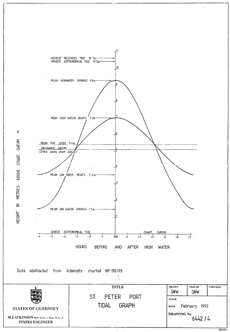
The height datum for the Guernsey Grid is based on the assumed mean tide level at St Peter Port. Mean tide level is half way between the highest and lowest tides – half tide. In 1996 the Guernsey Grid was established and the control for height was established by re-levelling reference bench marks around St Peter Port Harbour to ensure a consistency was achieved against the historic height data recorded for the island. Half tide has historically been recorded as 5.30m above Chart Datum. Ordnance Datum (Guernsey) is at 5.06m above Chart Datum. The 5.12m contour level will mark approximately the height of the highest predicted tide. Using the WGS84 ellipsoid the geoid / ellipsoidal separation value varies across the island by about 300mm, using the International Heyford ellipsoid it varies by only about 30mm . The mean values of the geoid / ellipsoidal separation values based on the WGS84 ellipsoid are 49.86m in Guernsey and 48.14m in Alderney
History
When St Peter Port harbour was built in the 1850s and 60s the mean tide level was inscribed in the stone at three places round the harbour. In the 1890s the Ordnance Survey surveyed the island, calculating the height of the bench marks and trigonometric points to the nearest 1/10 of a foot relative to one of these half tide marks. The chart datum, the lowest expected tide, has since been moved downward so that no negative height tides were thenceforth to be forecast.
Tidal curve for St Peter Port showing height datum